Our latest adventure was on Saturday, July 10. We had plans for a while to try to get to Camp Muir again, so we were thrilled that the weather was in our favor and the sun was out. It was relatively warm in Paradise when we arrived at 8 a.m. After getting all our gear on, we set out on the trail. It was a clear day, which was in sharp contrast to our attempt in June. We were actually able to see the summit as well as several mountains in the distance. The trail starts at 5,400 feet.
 The summit had a subtle cloud over the top for most of the day.
 Click on the picture above to see that just to the left of me, a deer came out of the bushes and ran across the path. It was probably only 10 feet away...not sure who was more skiddish, me or the deer.
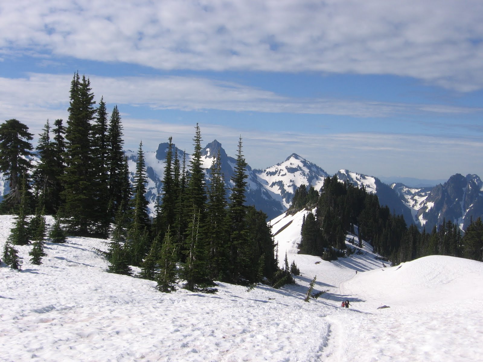 Great view of the trail behind us.
 Since we were surrounded by clouds on our last hike, we couldn't really tell where we were in relation to trees or Paradise or rock piles. It was nice to see everything this time.
 In the distance is Mt. Adams.
 There's Mt. St. Helens, which erupted 30 years ago in May.
 Here's Brian looking ready to get to the top.
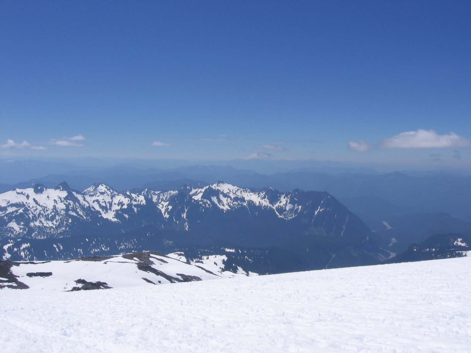
 If you click on the photo above, it will get larger and you will be able to see all three peaks, Mt. Adams in southern Washington on the left, Mt. Hood in northern Oregon in the middle, and Mt. St. Helens in southern Washington. It was amazing.
 Our second wildlife sighting was this marmot. He was running across the trail too trying to get away from the hikers. We later saw four more marmots and two were fighting for the best place on a particular rock.
 We're probably at 7,500 feet here.
 It was a sunny day, so we applied sunscreen five times on the way up and down. It was worth it because we didn't get burned at all. However, the sunscreen did get in our eyes on the way down...another joy of hiking.
 If you click on the photo above, you'll see the rock in the middle, which is called Anvil Rock. That is where Camp Muir is. From the trail, it doesn't look very far, but the mountain is deceiving.
 Here's a shot of the many people on the trail. We probably saw at least 300 people on the way up.
 This hill was the last steep one until Muir.
 A headache started to kick in for me here. I'm not sure if it was dehydration or altitude, but it wasn't very pleasant. On our next hike up to Muir on the 23rd, we're going to be more diligent about drinking 1/2 liter of water and electrolyte drinks every hour, stopping every hour to eat (probably pizza!), being hydrated before the hike and getting lots of sleep the week before.
 Getting closer...
 There's Mt. Adams in the distance. It sort of looks like Rainier, but it is a bit shorter at 12,281 feet.
 We made it to Camp Muir! All of the tents are lined up for the night. Most of these people will be trying to summit in the next couple of days. It seemed like a small village with people chatting, hanging out, and waiting for the outhouses...yes, there was a line for the three outhouses.
 The hut to the right belongs to the ranger from the national park.
 There's the three outhouses with a few people patiently waiting...
 After reaching Muir, we headed back down. After six hours of hiking up, it was a bit difficult to go down. But we made it in another three hours, which means we were on the mountain for 9 hours total. Needless to say, we were slightly exhausted after waking up at 4:30 am. We finally made it home at 10:30 pm and promptly went to sleep.
0 comments:
Post a Comment