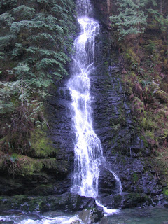
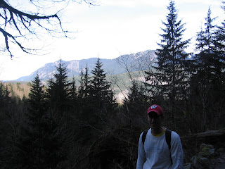
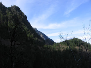
The weather last weekend was pretty incredible in Seattle, so on February 20 we took advantage of the warm temperatures and went on another hike. We ventured to Boulder River, which is off of Hwy 530 east of Arlington. This trail was just under 9 miles long with lots of rolling hills and a few muddy spots. 


Thursday, February 25, 2010
Hike 2: Boulder River
Friday, February 12, 2010
3-Day Muir Climb Itinerary
There are several ways to get to the top of Mt. Rainier. We are taking the Ingraham Glacier/Disappointment Cleaver route, which is open to any physically fit novice/beginner. According to our climbing guide service, Alpine Ascents, below is the 3-Day Muir Climb itinerary:
Day Before the Climb
Climbers are required to arrive in Seattle the afternoon before our trip begins. That afternoon at 2:00pm you will be met at our office by a guide and our gear manager to give you an overview of the climb, answer all your questions and make sure you have all your equipment or rental gear necessary for the climb. The guide will also give you instruction in Leave No Trace (appropriate wilderness practices) and discuss the National Park Mission Statement. You will return to your hotel for an early morning pick up on Day 1.
DAY 1
On the first day of the climb we meet at the Alpine Ascents Office at 6:00am, where we pack up the van and drive to Mount Rainier. There we meet the rest of the Alpine Ascents guide team.
After breakfast we drive into Mount Rainier National Park to a destination known as Paradise (5,400 ft). This beautiful area is the start for many nature hikes and is the starting point for our climb to Camp Muir (10,080ft). After donning our packs we hike Park trails to the snow line where we continue up on snow to Camp Muir. The hike takes 4 to 5 hours and we will stop to rest several times along the way and you will receive instruction on many topics such as moving efficiently on snow and discuss topics such as glaciology and vulcanology.
That night we sleep in our private hut at Camp Muir. The hut allows us to have further discussions on mountain topics as well as eat dinner in a private environment.
DAY 2
After breakfast we begin our training. We cover all aspects of self arrest, crampon and ice axe use as well as proper rope techniques for climbing the mountain. After lunch we pack our personal gear along with tents and climb across the Cowlitz Glacier over Cathedral gap to Ingraham Flats. (11,100 to 11,200 depending on where we camp). This two-hour climb allows us to train in rope management and glacier travel skills while bringing us to a beautiful and remote location at the base of the Ingraham Glacier. Here we establish our high camp. Our first goal is to make good tent sites that will protect our tents from the elements while we are on our summit attempt. Our guides will prepare the dining tent, boil water for our meals and give a detailed account of what will be required the next day. We go to bed early so that we can wake up around midnight and prepare for the summit climb.
DAY 3
Summit Climb!
We start our climb around midnight. After getting dressed we jump into the dining tent for breakfast and top off our water bottles. Our route depends on the time of year and conditions. We will either ascend the Disappointment Clever or the Ingraham Glacier Direct Route. As we are far ahead of those climbers coming from Camp Muir we will have the mountain to ourselves. It takes 4 to 5 hours to ascend to the crater rim and then another hour to Columbia Crest, the main summit of Mount Rainier. Along the way we route find around crevasses and seracs and make our way up the mountain clipping fixed protection with our climbing ropes when necessary. We take short rests along the way to hydrate and eat. As it is often cold these rest stops are frequent but short in duration. Our goal is to keep a moderate yet steady pace which allows us to keep warm during the early morning hours. After reaching the Crater Rim we take a longer break and if all is good, head across the crater itself for another hour to Columbia Crest.
After celebrating the summit and taking photos we descend carefully back to Ingraham Flats. Here we pack up our camp, rope up and climb back down to Camp Muir. Much of our gear will be left here for other expeditions that will be coming up. From Camp Muir we carry our personal gear back to Paradise and then drive back to Seattle for an evening of dining and fun.
Sounds like lots of fun!
Tuesday, February 9, 2010
Hike 1: Lake Serene
On Saturday, February 6 Brian and I made the trek to Lake Serene, located about 8 miles east of Gold Bar, WA on Hwy 2. I read about the hike to Lake Serene on the Washington Trails Association Web site, www.wta.org. It features tons of hikes with great directions and descriptions. The particular article that caught my eye was titled "Seasonal Hikes." Since February can be unpredictable in terms of trail conditions, I was curious to see which hikes are considered to be the best in the winter, and Lake Serene was perfect.
Sunday, February 7, 2010
Why Mt. Rainier?
- We can see Mt. Rainier during our daily commutes (on a clear day).
- It's the fifth highest mountain in the contiguous United States..it's just huge!
- Mt. Rainier National Park is one of our favorite national parks.
Look for our next post about our first training hike to Lake Serene soon!


